GEOPHYSICS & UTILITY LOCATING
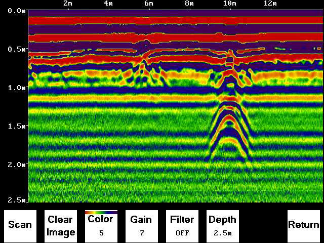
GPR Screen recording with a hyperbolic reflection
UTILITY LOCATING
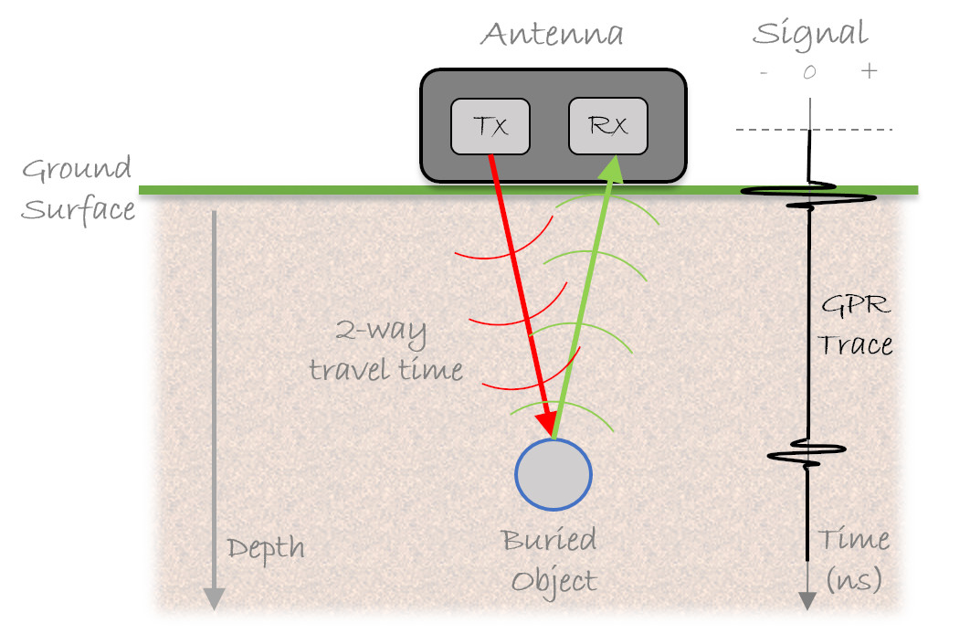
We utilize Ground Penetrating radar (GPR) tehnology to image the underlying utilities. The radar waves are send into the ground, reflecting at various interfaces. The time it takes for a wave to reflect and come back to the surface lets us measure the depth.
We have both shallower GPR units for examining concrete foundations/ walls and deeper units for gas, water, sewer, sanitary, electricity and communication utilities.